Gnanitztal hike to the huts at Gnanitz alp
Hiking · Stainach-Pürgg
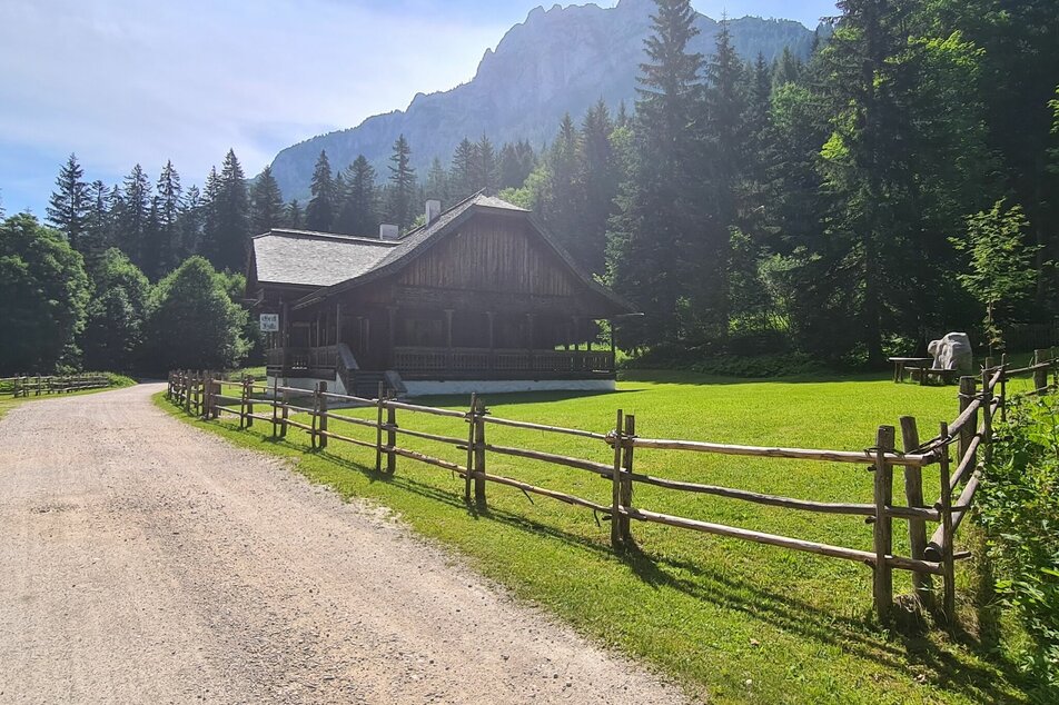
Beautiful hike along the Grimming river into the Gnanitztal. The wide forest path leads you through the forest and always offers direct access to the water of the torrent. Finally you reach the beautiful, open alpine area of the Gnanitzalm with several alpine huts. On this tour, the Böhmhütte, Johnsleitner Hütte and Hechlhütte invite you to stop off.
Gallery
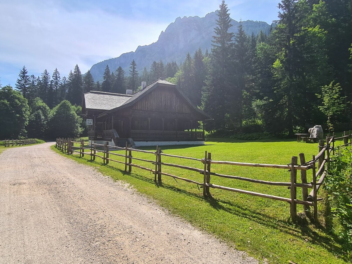
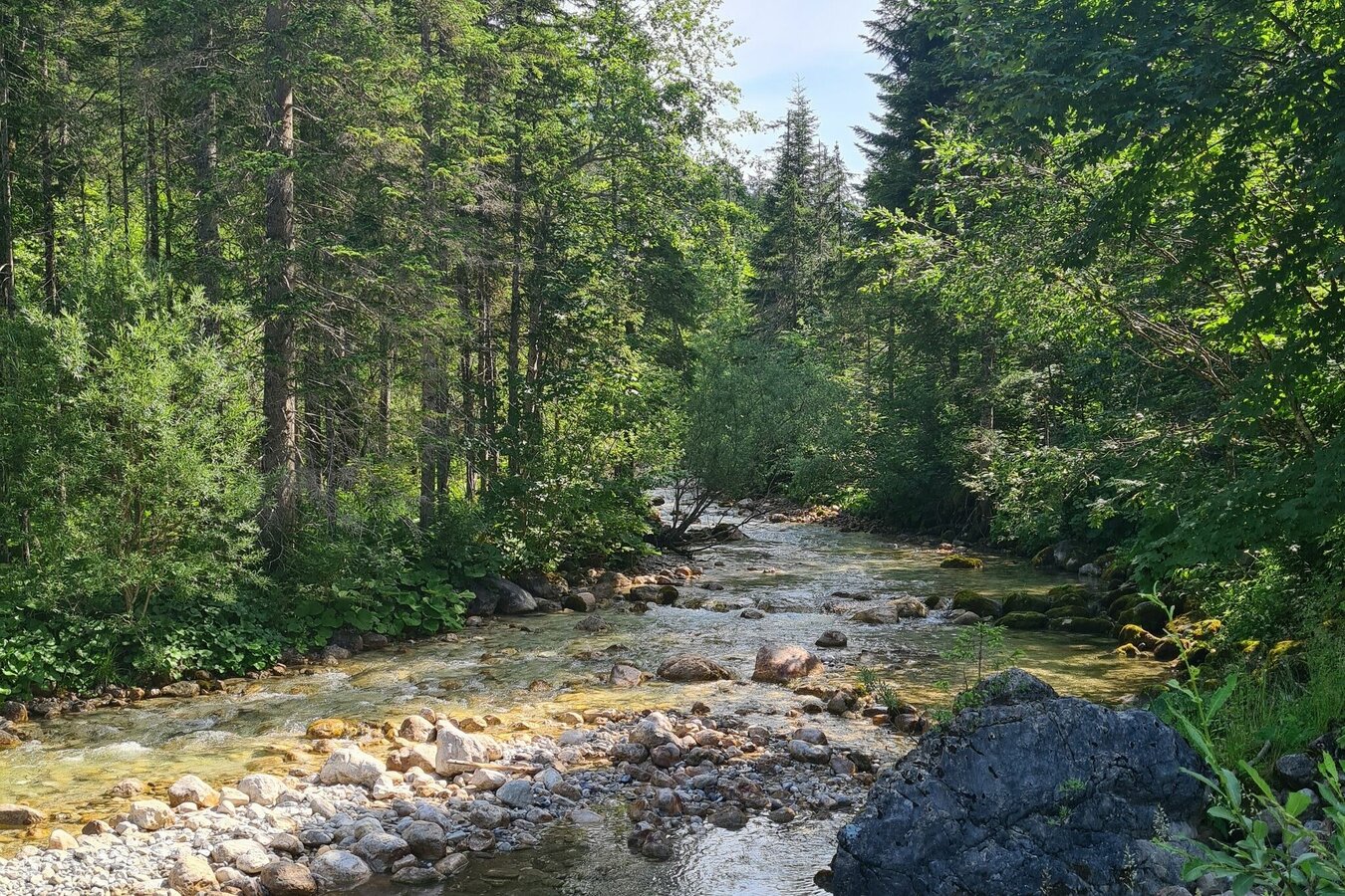
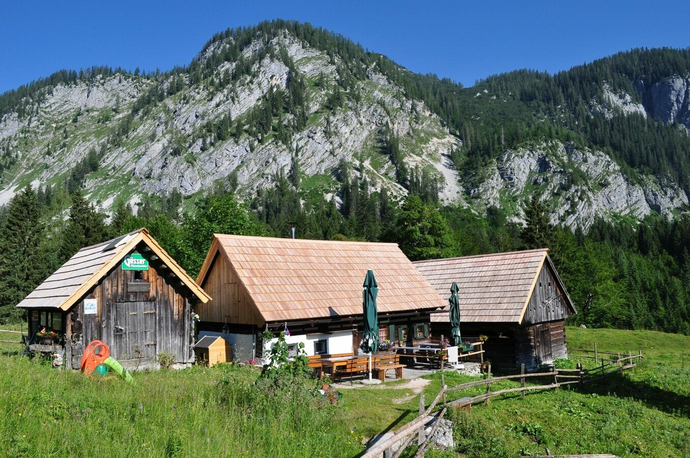
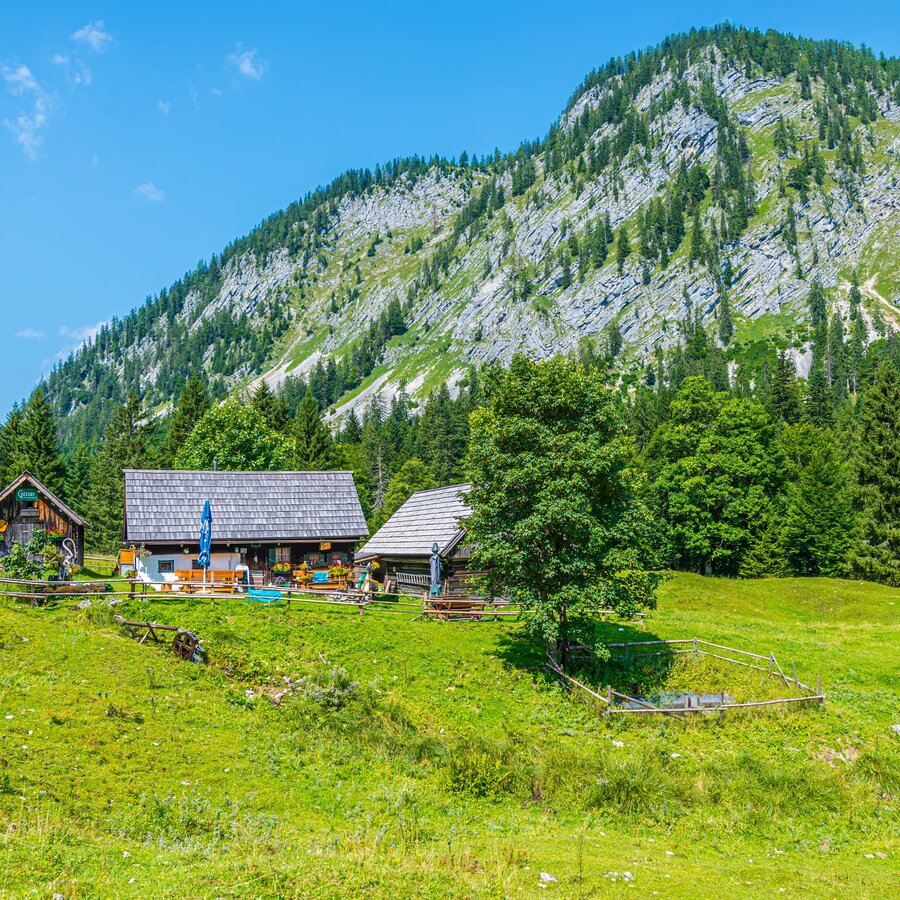
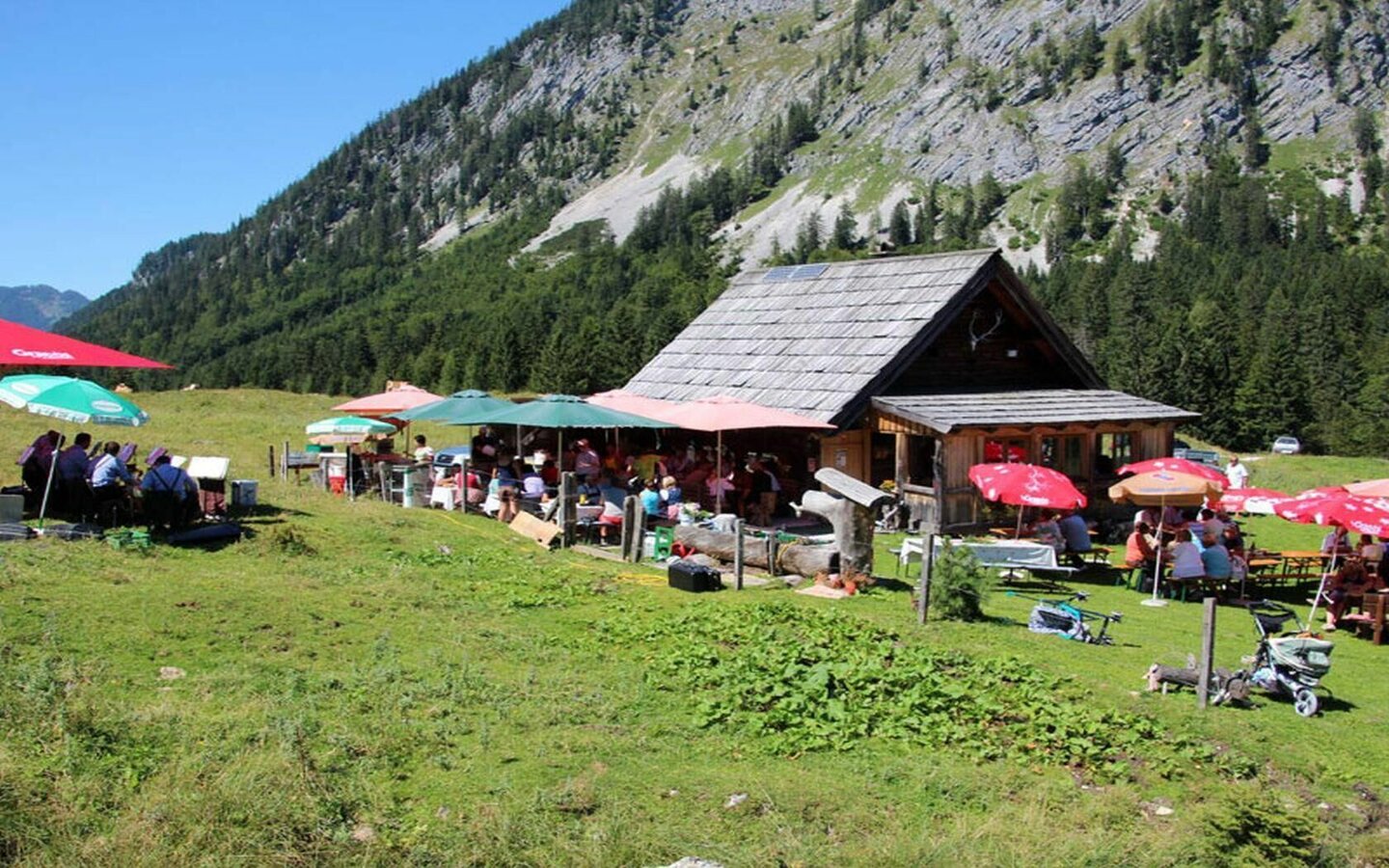


Behind the barrier at the Gnanitztal/Gretlhütte car park, follow the forest road to the east (trail #2). Right at the start you hike past the unmanaged Gretlhütte, which is structurally a real eye -catcher. We continue into the valley, always in the immediate vicinity of the Grimmingbach. You will soon reach the Böhmhütte, the first place to stop for refreshments. At the trail fork immediately afterwards you make a right and cross the bridge over the Grimming river. After just a few minutes the Gnanitz alpine area opens up in front of you. There are several alpine pastures and huts here, whereby the Hechlhütte and Johnsleitner Hütte invite you to stop.
A little further ahead you twist off the Almweg in front of the Fürtscher Hütte (unmanaged). You cross the Stubenbach and get up to a way crossing directly on a bridge over the Grimmingbach. You now go left over the bridge and follow the forest path back out of the valley. Shortly before the Böhmhütte the path closes back to the route you know from the way there. On this it goes back to the starting point.
From the B145 Salzkammergut Bundesstraße, exit in Klachau and continue towards Tauplitz. Turn right on the Tauplitzer bypass around the village and at the upper end of the village onto Gnanitzweg. Follow this to the Gretlhütte car park.
The starting point is not directly accessible to the public by train or bus. However, you can get to the starting point with the Salzkammergut Shuttle Service:
Car parking Gretlhütte
- Plan your tour in advance, taking into account walking time, route length, altitude difference, danger spots and weather forecast. Together is much more beautiful and at the same time safer in the mountains.
- Do not go alone, if possible, and adapt the tour to the ability of your group.
- Let someone know where you are going and when you want to be back. Also sign hut or summit books.
- Turn back in good time if the weather deteriorates. If you get caught in a thunderstorm, do not stay on the summit or ridge and stay away from individual trees. Wait out the storm, if possible in a crouching position.
- Stay on the marked trails and remember to close pasture fences again.
GPS data and orienteering
Available GPS data - just like hiking maps - is only a guidance for orientation and can never depict a trail exactly with all its details. Especially at dangerous spots it is essential to judge on site how to proceed.
In an emergency please call:
- 140 - for Alpine emergencies (all over Austria)
- 112 - European GSM emergency number
A well-packed backpack is helpful and especially when touring Alpine terrain a tuque, gloves, a windproof jacket and pants are standard equipment. Good, waterproof shoes, sun glasses, sun cream and sufficient beverages are essential too. Torch light, a map of the area, knie and a small first-aid kit should also be in the backpack.
SCHLADMING-DACHSTEIN summer experience map EAST, available at the information offices in the Schladming-Dachstein region.


